


Crève tête à partir du télécabine

91eric91
User
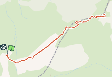

Length
6.2 km

Max alt
2323 m

Uphill gradient
473 m
Km-Effort
12.6 km

Min alt
1828 m

Downhill gradient
478 m
Boucle
Yes
Creation date :
2022-08-20 07:58:21.0
Updated on :
2022-08-20 10:16:06.483
2h17
Difficulty : Difficult

FREE GPS app for hiking
 SityTrail
IGN / Geographical institutes
SityTrail Plus
The world is yours!
About
Trail Walking of 6.2 km to be discovered at Auvergne-Rhône-Alpes, Savoy, Les Avanchers-Valmorel. This trail is proposed by 91eric91.
Positioning
Country:
France
Region :
Auvergne-Rhône-Alpes
Department/Province :
Savoy
Municipality :
Les Avanchers-Valmorel
Location:
Unknown
Start:(Dec)
Start:(UTM)
299869 ; 5035333 (32T) N.
Comments